Godrej Florenne Connectivity
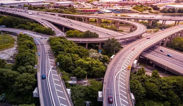
Featured Image of Godrej Florenne Connectivity


connectivity is strong, with a local bus stop barely a kilometre away on Soukya Road. Kadugodi Metro Station sits a short 12 to 15 minute drive out. Whitefield Railway Station is about 7 km away, on Whitefield Main Road. Ask anyone hunting for a home in East Bangalore, and connectivity comes up before amenities do. The numbers here work in the project's favour.

The airport is the one long haul in this picture, at roughly 38 km. The Satellite Town Ring Road cuts a fair bit off that drive. It runs just 1.3 km from the project gate. Distance on a map rarely tells the full story, though. What matters more is how long the drive actually takes once traffic gets involved. That's the lens this page uses throughout.


What Connectivity Actually Means Here


A home's connectivity isn't just a checklists line in a brochure. It decides how your mornings go and how often you see friends across town. It also shapes what the home is worth if you sell later. Godrej Florenne gets dependable BMTC bus coverage and a metro line within easy reach. Together, these cover most of what a household in this belt needs on a normal day.

NH 648 and Old Madras Road run close by too. Both link the project to the rest of the city. Neither one routes you through Bangalore's older, busier stretches near the centre.

Getting Around By Road


The closest bus stop sits right on Soukya Road, about a kilometre from the project. BMTC buses pass through at regular intervals. A ticket rarely costs more than ₹15 to ₹40, depending on where you're headed.

Drivers have a few solid picks too. NH 648 and Whitefield Main Road both funnel traffic toward central Bangalore. Old Madras Road offers a slightly different route east. Need the tech park cluster specifically? ITPL Main Road gets you there directly.

None of this stays free of traffic during rush hour, of course. Whitefield and the ITPL Road stretch back up like most IT corridors in this city. Plenty of residents shift their commute earlier or later just to dodge the worst of it.

Metro Access And What It's Worth


Kadugodi sits right at the end of the Purple Line. It happens to be the closest station to Godrej Florenne too. Figure on 12 to 15 minutes by road to cover the 5 km gap. Hopefarm Channasandra offer a second option a bit further along, handy if Kadugodi gets crowded during peak hours.

A single metro ride here runs anywhere from ₹10 to ₹60, based on distance. There's also a planned extension past Kadugodi. Once it lands, it should shave a few minutes off the trip for this side of Whitefield. Nothing dramatic, but every few minutes counts on a daily commute.

Rail Connections


Whitefield Railway Station is the nearest major rail link, about 7 km away via Whitefield Main Road. Traffic near the station can stretch that 15-minute drive to 18 or 20 on a bad day. Still, for anyone who takes the train often, a station this close removes a lot of hassle.

KR Puram Railway Station sits a bit further out. It works well as a backup, especially when Whitefield doesn't have a convenient departure time.

Reaching The Airport


Kempegowda International Airport is roughly 38 km from Godrej Florenne. The fastest route runs through the Satellite Town Ring Road onto NH 648. Under normal traffic, that's about 55 to 65 minutes behind the wheel. It's not a short trip. It is a predictable one, and that matters more than raw distance when you're catching an early flight.

Cab fares for this run usually land between ₹700 and ₹1,000. Expect this to swing a bit with surge pricing and the time of day.

The Road Network Around Soukya Road


A few roads do most of the heavy lifting on this stretch of Bangalore. Here they are by name.

  • NH 648, the main link between Soukya Road and the wider Whitefield corridor
  • Whitefield Main Road, running straight into the ITPL office belt
  • Old Madras Road, a direct path toward central and east Bangalore
  • ITPL Main Road, for anyone working in the tech park cluster
  • Satellite Town Ring Road, sitting just 1.3 km from the project itself

Between these five routes, most destinations across East Bangalore stay within reach.

How Long It Takes To Reach The Rest Of The City


Travel time bends around traffic more than distance ever does. Here's roughly what to expect on a normal day.

Destination Rough Distance Typical Travel Time
Marathahalli 10 km 20 to 25 minutes
KR Puram 11 km 20 to 25 minutes
Indiranagar 20 km 35 to 40 minutes
MG Road 24 km 45 to 50 minutes
Electronic City 35 km 60 to 70 minutes

Add extra time during peak hours near Whitefield and the Outer Ring Road. Anyone who has driven this stretch at 6 pm on a weekday already knows why.

Office Hubs Within Easy Reach


Soukya Road sits close enough to several major job clusters. A lot of residents here simply drive to work instead of dealing with a long commute. EPIP Zone is about 6 km out, roughly a 10 to 12 min drive. ITPL sits at around 7 km. Prestige Shantiniketan's business precinct stays close too, at roughly 6 km.

That proximity is exactly why so many professionals pick this part of Whitefield over other pockets of the city. A shorter commutes buys back real time. Most buyers factor that in just as heavily as the home itself.

Why This Matters If You're Buying Here


Good connectivity pays off twice. It makes daily life easier right now. It also tends to hold up property values better down the line. Future buyers will care about the same things you do today. Residents at Godrej Florenne can reach work, schools, hospitals and public transport without an unreasonable drive. The Satellite Town Ring Road, running just 1.3 km away, only adds to that.

As Bangalore's metro network keeps stretching further east, commute times from this belt should keep shrinking rather than growing. Between the roads, the rail link, the metro and the airport, Godrej Florenne covers what a household actually needs. Not just what looks good on paper.

FAQs


1. How far is Godrej Florenne from Kempegowda Airport?

About 38 km, which usually works out to a 55 to 65 minutes drive via the Satellite Town Ring Road and NH 648.

2. What is the nearest metro station to Godrej Florenne?

Kadugodi Metro Station, roughly 5 km away and about 12 to 15 minutes by road.

3. Is Godrej Florenne well connected by bus?

Yes. A local BMTC stop sits about a kilometre away on Soukya Road. Buses run through the day at regular intervals.

4. How long does it take to reach MG Road from here?

Around 45 to 50 minutes for roughly 24 km. This can stretch further during peak traffic near the city centre.

5. Is there a railway station near Godrej Florenne?

Whitefield Railway Station sits about 7 km away, reachable in 15 to 20 minutes depending on traffic near the station.

6. Does the Satellite Town Ring Road actually help residents here?

It does. Running just 1.3 km from the project, it shortens the drive across East Bengaluru, including the stretch toward the airport.

Enquiry
Enquire Now