Satellite Town Ring Road (STRR / NH-648): What It Means for Soukya Road
Featured Image of Satellite Town Ring Road (STRR / NH-648): What It Means for Soukya Road


The Satellite Town Ring Road (STRR) gives Soukya Road a signal-free link to Hoskote and the airport side. Once complete, it also takes you to Hosur. Its Hoskote to Tamil Nadu border stretch runs close to the eastern end of Soukya Road. For you, that means faster airport trips, quick Chennai Expressway access and less time on Old Madras Road.

Quick Fact Details
Full name Satellite Town Ring Road (STRR)
Highway numbers NH-648 and NH-948A
Planned network About 280 km around Bengaluru
Open section Dobbaspet to Hoskote, 80 km, since March 2024
Section near Soukya Road Hoskote to Tamil Nadu border, 20.9 km
Lanes Four to six, access-controlled
Key towns Dobbaspet, Doddaballapur, Devanahalli, Hoskote, Sarjapur, Attibele, Hosur

What Is the Satellite Town Ring Road?


The STRR is a large outer ring road that circles Bengaluru through its satellite towns. It avoids the city's inner roads and links towns like Doddaballapur, Devanahalli, Hoskote, Sarjapur and Anekal. The idea is simple: send long-distance trucks and through traffic around the city, not through it.

NH-648 forms a major part of this ring, running about 143 km from Dobbaspet to Hosur. Together with NH-948A on the western side, it makes up the full STRR alignment.

Which Sections Are Open Today?


The STRR opens in stages, and it helps to know which parts you can use right now.

Section Length Status
Dobbaspet to Doddaballapur bypass 42 km Open, tolled since June 2024
Doddaballapur bypass to Hoskote 38 km Open, six lanes, tolled since November 2023
Hoskote to Tamil Nadu border (towards Hosur) 20.9 km Targeted for June 2026, check current status
Dobbaspet to Ramanagara (western arc) 82 km Under development
Southern stretch near Bannerghatta 56 km On hold

The 80 km stretch from Dobbaspet to Hoskote opened formally on 11 March 2024. The Hoskote to Hosur link ran about 16 months late because of a 54-metre railway overbridge. So before you rely on it, confirm its status on the NHAI website or a live map.

How the STRR Connects to Soukya Road


The Hoskote to Tamil Nadu border stretch follows a realigned route of the old NH-207. This alignment passes close to the eastern end of Soukya Road, near Hemmandahalli. From there, you can head north to Hoskote, or south towards Sarjapur, Attibele and Hosur.

That position gives Soukya Road something most Whitefield localities lack. You can leave the area without touching Hope Farm, ITPL Main Road or Old Madras Road. For a detailed route to Hoskote, read our guide on Soukya Road to Hoskote distance.

Faster Airport Trips


The biggest daily gain for Soukya Road comes on airport runs. From Hoskote, the open STRR section runs north through Sulibele and Devanahalli towards Kempegowda International Airport. This route skips Hebbal, KR Puram and the city's inner traffic completely.

Trip From Soukya Road Without STRR With STRR
Kempegowda International Airport 75 to 100 minutes via city roads 55 to 75 minutes via Hoskote
Hoskote town 25 to 35 minutes via village roads 15 to 25 minutes once fully open
Sarjapur and Attibele 50 to 70 minutes via Whitefield 30 to 45 minutes once fully open
Hosur 75 to 100 minutes via Hosur Road 45 to 60 minutes once fully open

These times are estimates and depend on traffic, tolls and which sections are open on the day.

Link to the Bengaluru-Chennai Expressway


The Bengaluru-Chennai Expressway starts at Hoskote, and the STRR ties directly into it. For Soukya Road residents, this means a quick route to Kolar, Vellore and Chennai. For businesses, it means faster freight to Chennai port and the eastern industrial belt.

What It Means for Daily Life on Soukya Road


The STRR changes more than airport trips. Trucks that once crossed Old Madras Road and Sarjapur Road can now bypass the city on the ring. That shift should ease some pressure on the roads that Soukya Road residents use for city trips.

You also gain quicker access to jobs outside Whitefield. Volvo in Hoskote, the Narasapura industrial area and the Sarjapur IT belt all come within easier reach. Families can plan weekend drives to Nandi Hills or Hosur without crawling through the city.

What It Means for Property on Soukya Road


Ring roads tend to lift demand for homes in towns and localities close to their exits. The STRR's eastern arc puts Soukya Road near the point where the ring meets the Chennai Expressway. That mix supports long-term demand from both families and investors.

Still, stay careful with any price claim linked to a road opening. The Hoskote to Hosur stretch has missed deadlines before, so never pay a premium for a promised date. Judge a project on what exists today, and treat full STRR access as an added bonus.

Where Godrej Florenne Sits Along the STRR


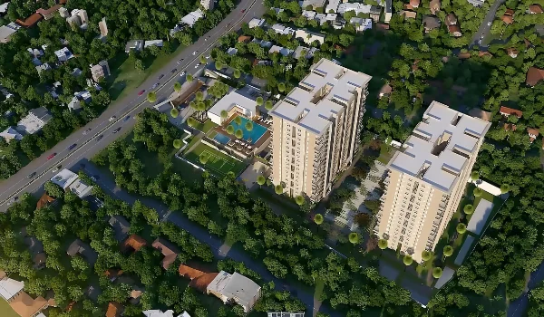
Godrej Florenne sits at Hemmandahalli on Soukya Road, with the STRR about 800 m from the site. The project plans 218 G+3 rowhouses across 20 acres, with Phase 1 handover set for October 2030. By then, the ring road's eastern links should be well settled, which eases daily travel from the project.

Each home comes with two covered car parks and EV charging, which suits families that drive often. See how the STRR, metro and rail link to the site on the Godrej Florenne connectivity page.

FAQs


1. What is the STRR in Bangalore?

The STRR is an outer ring road that circles Bengaluru through satellite towns like Hoskote, Devanahalli and Sarjapur. It runs as NH-648 and NH-948A, with four to six access-controlled lanes.

2. Is the STRR open near Hoskote?

Yes, the 80 km Dobbaspet to Hoskote stretch opened in March 2024. NHAI set a June 2026 target for this link, so check its status before you travel.

3. How far is the STRR from Soukya Road?

The STRR's Hoskote to Hosur alignment runs close to the eastern end of Soukya Road. Near Hemmandahalli, it sits under 1 km away, based on your exact location.

4. How does the STRR help airport trips from Soukya Road?

You can drive to Hoskote and take the STRR north through Devanahalli to the airport. This route skips Hebbal and KR Puram, cutting the trip to about 55 to 75 minutes.

5. Is the STRR a toll road?

Yes, NHAI collects tolls on the open sections from Dobbaspet to Hoskote. Rates depend on your vehicle type and distance, so check the NHAI website for current charges.

6. Will the STRR raise property prices on Soukya Road?

Better road links tend to support long-term demand. The final stretch has faced delays, so judge each project on today's access alone.

Godrej Florenne Blog


Enquiry
Enquire Now