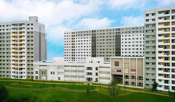
Godrej Florenne Location

Godrej Florenne Location is on Soukya Road in Whitefield, East Bengaluru 560117, one of the city's key IT and residential hubs. The project site is right off the Satellite Town Ring Road and is a short drive from major tech clusters like ITPL and EPIP. It also offers easy access to the Kadugodi and Hope Farm metro stations on the Purple Line. This page details the exact address, transit links by road, metro, rail, and air, as well as nearby schools, hospitals, workplaces, and malls.
Why the Location Matters
The location matters because it gives you the best of both worlds: fast work commutes and a peaceful home life. Situated on Soukya Road on Whitefield's eastern edge, Godrej Florenne offers quick access to major IT hubs. At the same time, its green and quiet surroundings keep you away from heavy traffic. This makes it an ideal setting for a low-rise rowhouse community.
For a home, location shapes both daily life and long-term value. Godrej Florenne is planned around three advantages: fast road access through the Satellite Town Ring Road, proximity to the Whitefield and ITPL job market, and a growing base of schools, hospitals and shopping within a short drive. Together these make the address convenient to live in today and well placed for the future.
Godrej Florenne Address

Godrej Florenne, Soukya Road, Whitefield, East Bengaluru, Karnataka 560117.
- Latitude: 12.9721556 N.
- Longitude: 77.7987938 E.
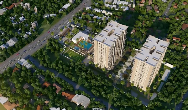
- Access road: Soukya Road, just 800 m from National Highway 648 (the Satellite Town Ring Road).
Godrej Florenne Connectivity

Godrej Florenne is well connected by road, metro, rail, air and bus. The Satellite Town Ring Road runs close to the site, the Purple Line metro serves the corridor, and Whitefield Railway Station and Kempegowda International Airport are both reachable through the ring road network.
Road Connectivity
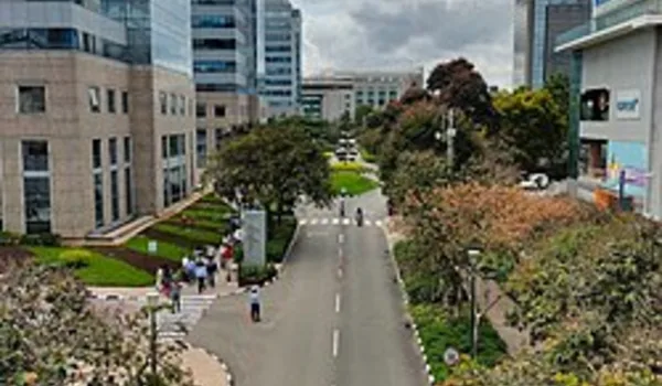
Soukya Road links the community to the wider East Bengaluru road network.
- Satellite Town Ring Road (NH-648): just 800 m, giving fast, signal-light-free travel across the eastern belt and on to the airport.
- Old Madras Road and Whitefield Main Road: connect onward to the Outer Ring Road and central Bengaluru.
Metro Connectivity
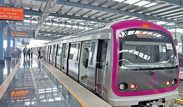
Two Namma Metro Purple Line stations serve the Whitefield corridor, linking the community west across the city to Challaghatta.
- Kadugodi Tree Park Metro: about 7.3 km, roughly 24 minutes by road; an elevated Purple Line station that opened in March 2023.
- Hopefarm Channasandra Metro: about 7.5 km, roughly 24 minutes by road; an elevated Purple Line station that opened in March 2023.
- Line interchange: the Purple Line meets the Green Line at Nadaprabhu Kempegowda Station (Majestic), about 19 to 24 km west, so passengers can change lines to reach the rest of the city.
Rail Connectivity
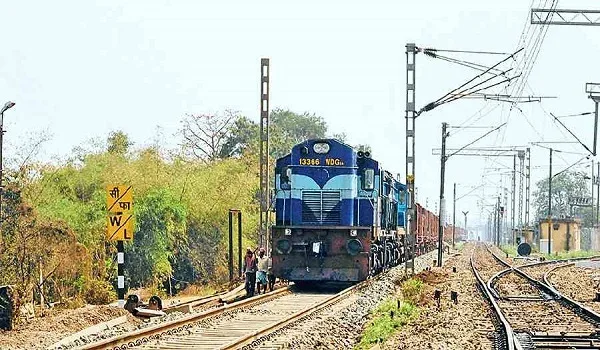
Suburban and express rail services run from the nearby Whitefield hub.
- Whitefield Railway Station: about 7 km, roughly 22 minutes by road. A South Western Railway station with 4 platforms and around 50 trains a day to destinations such as KSR Bengaluru, Bangarpet, Chennai and Howrah.
- Multi-modal and upgrades: it is about 1 km from the Whitefield (Kadugodi) metro for easy transfers, and is being redeveloped with a food plaza, a wider foot-overbridge and new parking.
Air Connectivity
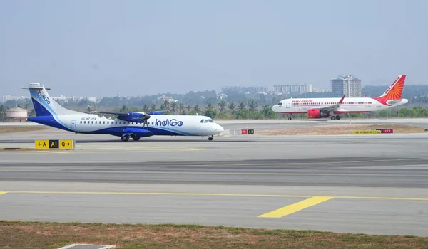
The airport is reached through the Satellite Town Ring Road, which keeps the drive largely free of city traffic.
- Kempegowda International Airport: about 51 km, roughly 1 hour 15 minutes by road via the Satellite Town Ring Road.
Bus Connectivity
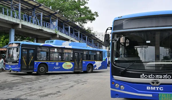
Local BMTC services connect the corridor to Whitefield, central Bengaluru and the towns around the city.
- Bhodhana Hosahalli bus stop: just 800 m, the nearest stop, with routes toward Chikka Thirupathi, Devanagondi and Muthkur.
- Samethanahalli bus stop: about 2 km, with BMTC routes such as 500-HC to Hebbal Bridge, 304-VB to Tin Factory, 390 to Hoskote, 335-H to HAL Main Gate, 306-K to KR Market and 304-X to Kempegowda.
- Kempegowda Bus Station (Majestic): the main bus terminus in central Bengaluru, about 30 km away; it can also be reached by a local bus to Kadugodi Tree Park metro and the Purple Line into the city.
Tech Parks and Workplaces near Godrej Florenne
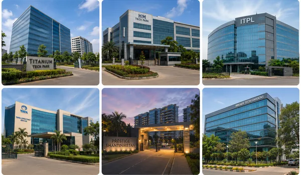
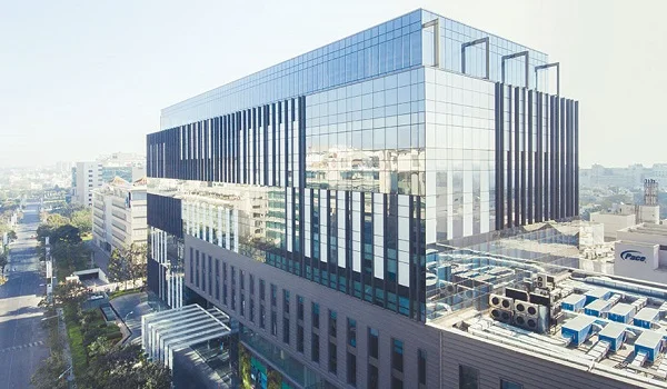
Godrej Florenne puts residents just a short drive from Whitefield's top tech parks, including ITPL and EPIP Zone. These major hubs employ a large portion of Bengaluru's technology workforce.
| Tech Park / Workplace | Distance | By Road |
| Titanium Tech Park | about 7.2 km | about 25 min |
| H M Tech Park | about 8 km | about 26 min |
| ITPL | about 8.8 km | about 30 min |
| Tata Consultancy Services | about 9 km | about 30 min |
| Prestige Shantiniketan, Whitefield | about 10.7 km | about 37 min |
| Brigade Tech Gardens | about 14.2 km | about 42 min |
Schools near Godrej Florenne
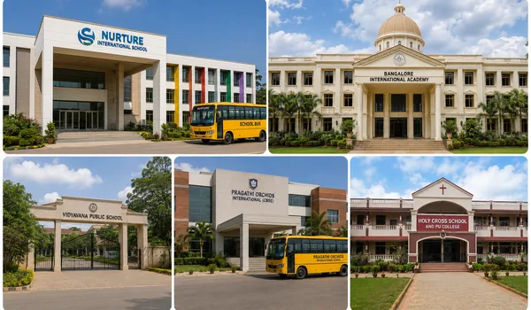
Families at Godrej Florenne have a choice of established schools within a short drive.
| School | Distance | By Road |
| Nurture International School | about 2.4 km | about 8 min |
| Bangalore International Academy | about 3.7 km | about 10 min |
| Vidyavana Public School | about 3.7 km | about 12 min |
| Pragathi Orchids International (CBSE) | about 6.7 km | about 25 min |
| Holy Cross School and PU College | about 7.8 km | about 25 min |
Colleges near Godrej Florenne
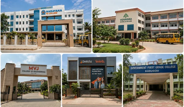
Higher-education options, from pre-university colleges to an engineering college, are close to the community.
| College | Distance | By Road |
| Narayana PU College | about 2.8 km | about 9 min |
| Vidyavana School and College | about 3.7 km | about 12 min |
| MVJ College of Engineering | about 5.6 km | about 17 min |
| Deeksha Vedantu, Whitefield | about 6.1 km | about 18 min |
| Government First Grade College, Kadugodi | about 6.4 km | about 19 min |
Hospitals near Godrej Florenne
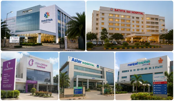
Whitefield's healthcare network, including multi-specialty and maternity hospitals, is within easy reach.
| Hospital | Distance | By Road |
| Svastha Hospital | about 8.6 km | about 27 min |
| Sathya Sai Hospital | about 9.8 km | about 32 min |
| Cloudnine Hospital, Whitefield | about 9.9 km | about 32 min |
| Aster Hospital, Whitefield | about 10.4 km | about 34 min |
| Manipal Hospital, Whitefield | about 10.4 km | about 34 min |
Shopping and Entertainment near Godrej Florenne

Malls, multiplexes and high streets across the Whitefield corridor cover everyday shopping and weekend leisure.
| Mall / Destination | Distance | By Road |
| Dress Circle Mall, Whitefield | about 8.4 km | about 27 min |
| Park Square Mall | about 8.4 km | about 27 min |
| Nexus Whitefield | about 9.2 km | about 28 min |
| Nexus Shantiniketan | about 10.8 km | about 37 min |
| Phoenix Marketcity | about 14.9 km | about 48 min |
Key Distances from Godrej Florenne
A quick summary of the main distances from Godrej Florenne
| Destination | Distance |
| Satellite Town Ring Road (NH-648) | just 800 m |
| SOUKYA International Holistic Health Centre | about 3.9 km |
| Kadugodi Tree Park Metro (Purple Line) | about 7.3 km |
| Whitefield Railway Station | about 7 km |
| ITPL | about 8.8 km |
| Kempegowda Bus Station, Majestic | about 30.1 km |
| Kempegowda International Airport | about 51 km |
About Whitefield
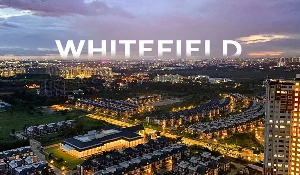
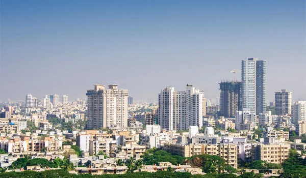
Whitefield is one of Bengaluru's best-known IT and residential hubs on the East side of the city. What started as a quiet farming village is now a vibrant district where people can live, work, and play, supported by major tech parks and the Namma Metro Purple Line.
How Whitefield Developed
- Colonial roots (1882): David White founded the settlement on land granted by the Maharaja of Mysore. It remained a quiet village for over a century.
- The IT boom (1998): The opening of International Tech Park Bangalore (ITPL) attracted global tech companies. Farmland quickly turned into tech campuses like EPIP Zone, gated communities, and shopping centres.
Whitefield Today
- A major economic centre: Whitefield hosts hundreds of multinational companies and tech offices, driving East Bengaluru's economy.
- Complete amenities: Top hospitals, international schools, and major shopping malls like Phoenix Marketcity serve the area.
- Strong connectivity: The Namma Metro Purple Line directly connects Whitefield to central Bengaluru, ending at the Kadugodi terminus.
About the Soukya Road Corridor
Soukya Road runs along the eastern edge of Whitefield toward Hoskote. It takes its name from the nearby SOUKYA International Holistic Health Centre. Once a quiet, green area, it is now one of East Bengaluru's fastest-growing residential belts.
How the Area Developed
- A peaceful, green start: The road was known mainly for its holistic wellness centre, keeping the area calm, green, and non-commercial for years.
- Expanding from Whitefield: As Whitefield's core became fully built, growth expanded along Soukya Road. The area's development gained momentum thanks to National Highway 648, the Satellite Town Ring Road, and nearby Purple Line metro stations at Kadugodi and Hope Farm.
The Area Today
- Spacious, green homes: The corridor is now a well-planned residential market. It offers larger homes and open green spaces, all within a short drive of Whitefield's workplaces, top schools, and hospitals.
- Upgraded infrastructure: Road widening projects, established schools, and modern healthcare facilities serve the neighbourhood. Upcoming projects, like Peripheral Ring Road and Suburban Rail System, will make travel even faster in the future.
Frequently Asked Questions
1. Where is Godrej Florenne located?
Godrej Florenne is on Soukya Road, Whitefield, East Bengaluru 560117, on the eastern edge of Whitefield toward Hoskote.
2. How far is the metro from Godrej Florenne?
The Kadugodi Tree Park and Hopefarm Channasandra metro stations on the Purple Line are about 7.3 to 7.5 km away, roughly 24 minutes by road.
3. How far is Godrej Florenne from the airport?
Kempegowda International Airport is about 51 km, roughly 1 hour 15 minutes by road via the Satellite Town Ring Road.
4. Which tech parks are near Godrej Florenne?
ITPL is about 8.8 km, with the EPIP Zone, Titanium Tech Park and Brigade Tech Gardens all within the wider Whitefield corridor.
5. Are there schools and hospitals near Godrej Florenne?
Yes. Schools such as Nurture International are within about 2.4 km, and hospitals including Svastha, Aster and Manipal Whitefield are within about 8 to 11 km.
6. Is Godrej Florenne well connected by road?
Yes. The Satellite Town Ring Road is just 800 m away, giving fast access across East Bengaluru and on to the airport.
Godrej Florenne Blog